What Spain’s trail markings are telling you
White and red, white and yellow, white and green. What sets a GR apart from a PR, what the cross means and who certifies the trails.

The three types and their colours
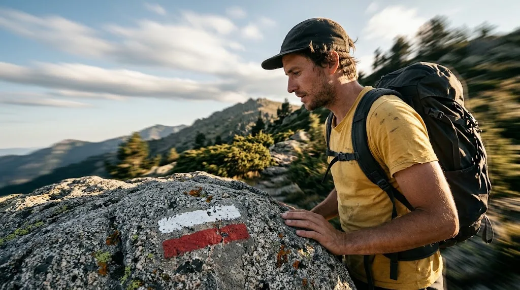
Those two stripes painted on a rock aren’t decoration or some local quirk: they’re a standardised system, and the colour of the bottom stripe tells you what kind of trail you’re on.
| Trail | Colours | Length | What it usually is |
|---|---|---|---|
| GR · Gran Recorrido (long-distance trail) | White and red | Over 50 km | Links districts, regions or countries. Walked in stages over several days |
| PR · Pequeño Recorrido (short-distance trail) | White and yellow | 10 to 50 km | A valley, a peak, a mountain hut. The classic weekend day out |
| SL · Sendero Local (local path) | White and green | Under 10 km | A waymarked walk around a village or a local beauty spot |
In all three, the white band always goes on top and the coloured one underneath. If you see a number with a decimal point – GR 11.1, for example – you’re on a variant of the main trail: an approved alternative section, not a painting mistake.
And a warning that saves a few frights: certified doesn’t mean easy. Certification says the route is waymarked and maintained to a common standard, not that it’s comfortable. There are GRs that cross passes at 2,500 m and PRs with stretches where you’ll need your hands.
The key number
There are only three marks to learn, and the one people get wrong most often is the cross: two rectangles crossed in an X. It doesn’t show a direction: it means ‘not this way’. Lots of people read it as a junction or a warning sign and carry on. If you see a cross, the right thing to do is turn round and look for the last continuation mark you saw.
Continuation, change of direction and the cross
Continuation
ON TRACKTwo parallel rectangles, one above the other: white on top and the trail’s colour below, each between 9 and 15 cm long. It means exactly ‘carry on this way’. It’s the mark you’ll see most often and the one you should be looking out for every few minutes: if you’ve gone a good while without seeing one, something’s up.
Change of direction
TURNThe same two stripes, but forming an angle, like a bent arrow. The outer stripe is the white one. It warns you that the trail is leaving the path you’re on and turning off, usually towards the side the elbow points to. It’s normally just before the turn, not on it.
Wrong way
NOT THIS WAYA cross, with one white diagonal and the other in the trail’s colour. It’s painted on paths that branch off the right one and that people take by mistake. It isn’t a danger warning or a junction: it’s the mark telling you that branch isn’t the trail.
Those three cover almost everything. There’s also vertical signage – the trailhead information boards, the wooden fingerposts with walking times – but that varies a lot from one area to the next; the three painted marks don’t.
Who certifies a trail
The GR®, PR® and SL® marks are registered trademarks of FEDME, the Spanish Mountain Sports and Climbing Federation, and have been registered with the Spanish Patent and Trademark Office since 2002. Management is delegated to each regional federation within its own territory.
That has a practical consequence that surprises a lot of people: nobody can paint two white and red stripes on their hillside just because they feel like it. A trail gets certified by following the relevant federation’s protocol, which checks the route, the access permissions, the waymarking and – the hardest part – the commitment to maintain it. Behind every mark there’s an organisation that answers for it and volunteers who repaint it.
When you come across marks in other colours, stone cairns or plastic tape tied to branches, you’re on something else: a local route, the markings for a race or somebody’s own idea. It may be perfectly well laid out, but nobody guarantees it’ll still be there next year.
The official description of the system, with exact measurements and sign types, is published in the FEDME trails manual (in Spanish). It’s worth reading once.
What to do when the marks disappear
It happens all the time and it’s rarely your fault: vegetation swallows a rock in summer, snow buries the marker post, felling takes away the painted tree, or the trail was waymarked with the opposite direction in mind – marks are painted to be seen in one direction of travel, and walking the other way they’re only half as easy to spot.
There’s only one rule and it has no exceptions: go back to the last mark you saw. Don’t keep going ‘a bit further to see if one turns up’ – that’s how afternoons end up spent hunting for the path through the scrub. From the last mark you know, look around calmly: the next one is almost always in sight if you stand in the right spot.
And three habits that stop this being a problem: having the track downloaded – not open in a browser tab, downloaded – checking the time before improvising a shortcut, and not trusting everything to the marks or everything to your phone. Both let you down, but rarely at the same time.
What Suviard does about this
Nothing, and that’s deliberate. The waymarking isn’t ours: it’s a public system, maintained by federations and volunteers, and we have no intention of duplicating it or putting a layer on top of it.
What the app does do is the complementary part: it lets you carry the route’s track, downloaded, for the times when the marks aren’t there. A track doesn’t replace waymarking – it doesn’t know that branch is private, or that the bridge was swept away in a flood – but it does tell you whether you’re still on the line when snow has wiped out the ground.
And then there’s the symmetry, which is the honest argument: the marks are still there when your battery dies, and the track is still there when the mark is buried under snow. That’s why you take both. To stop the first from happening, see how to record a six-hour hike and still have battery left.
In short
White and red, over 50 km. White and yellow, 10 to 50. White and green, under 10. Two parallel stripes mean carry on, at an angle they mean turn, and crossed they mean go back. With that, and the habit of looking for the next mark every few minutes, you can walk half of Spain.
The system works because there are people who repaint those stripes every season without being paid a cent for it. Knowing how to read them is useful, and it’s also the cheapest way to respect their work.
More on how we work with data: about Suviard.